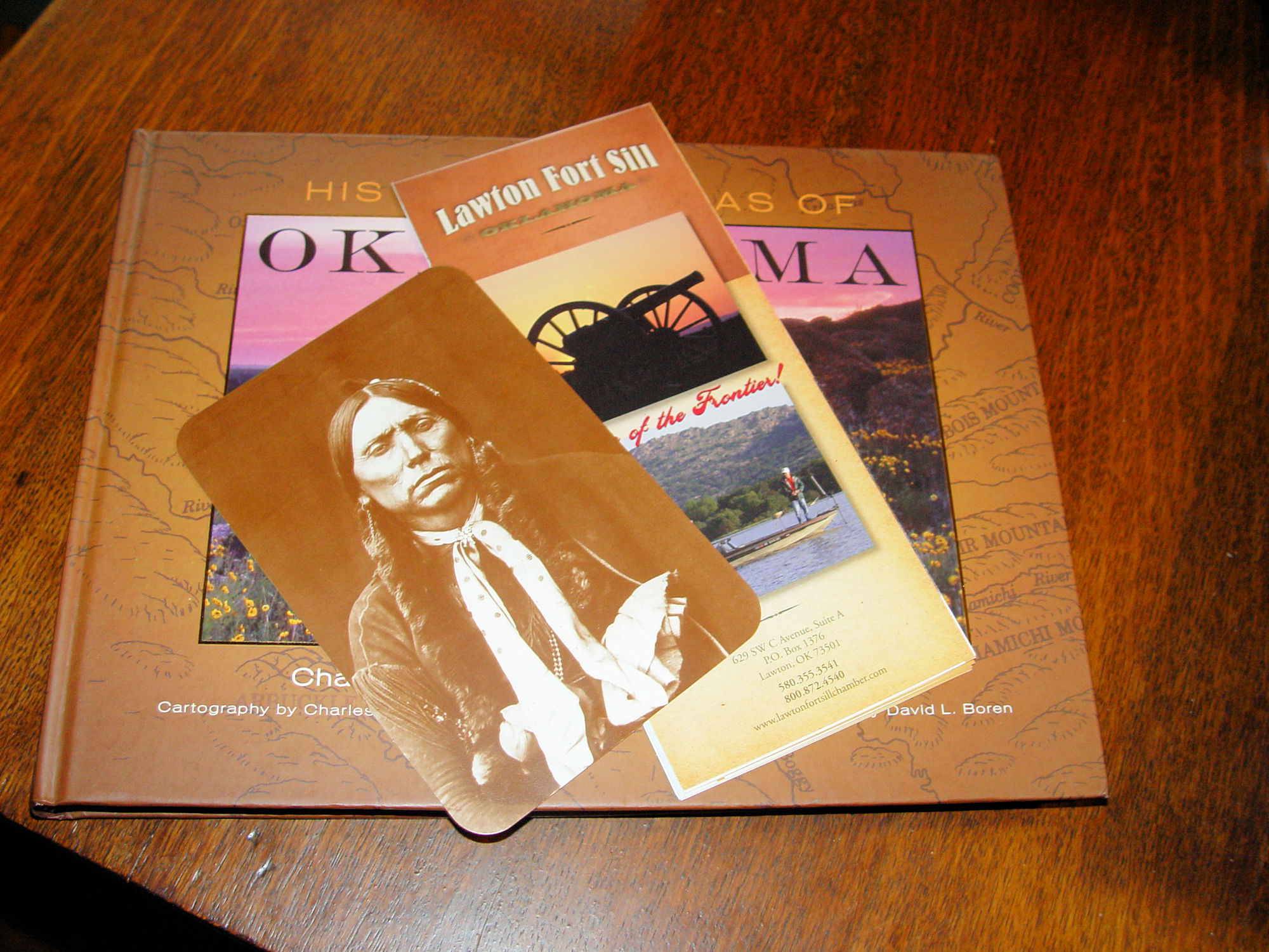
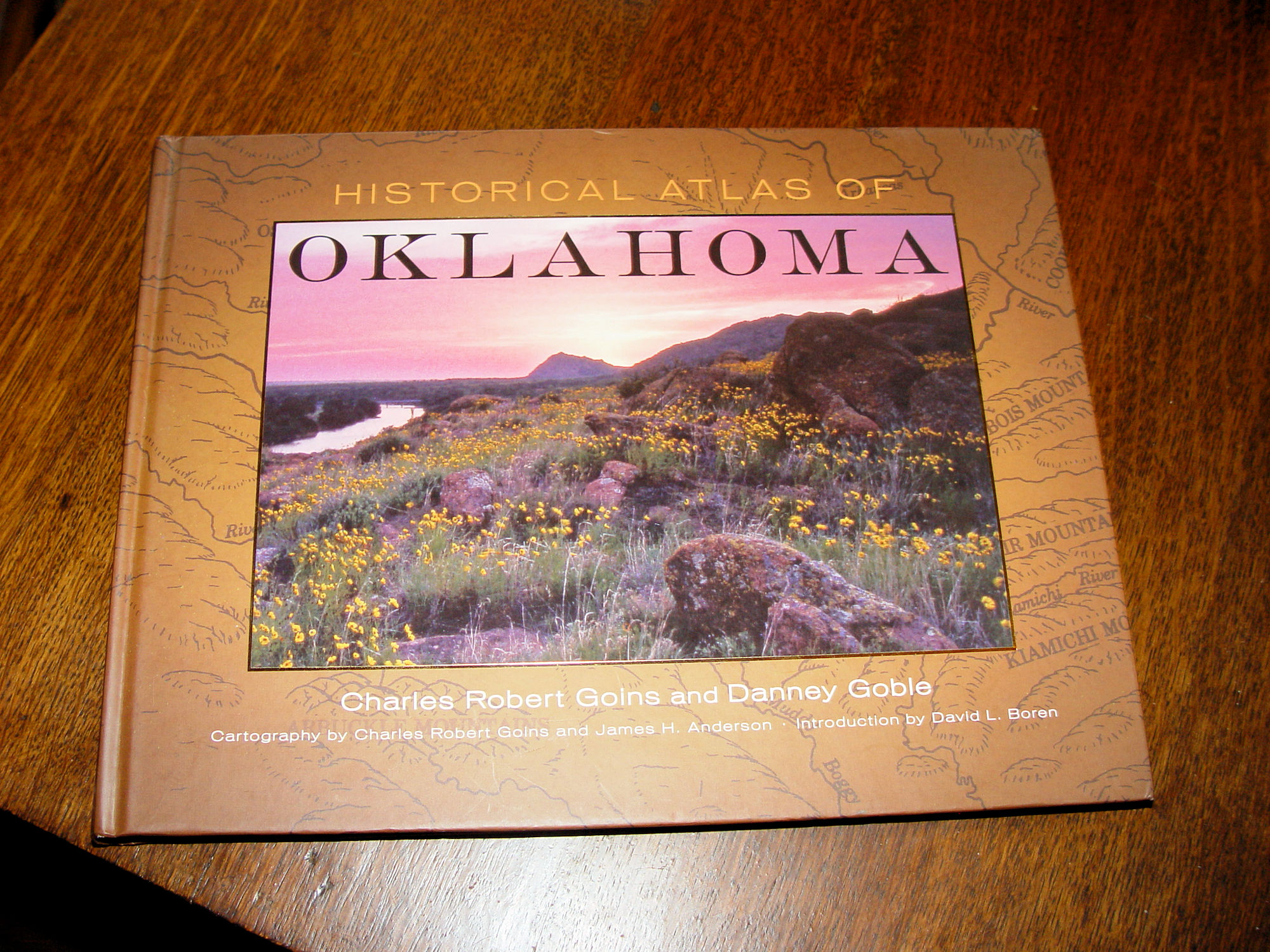
Historical Atlas of Oklahoma by Goins & Goble Quanah Parker PC, Lawton Fort Sill |
Item #: BOC805 Our price: $40.00 |
        |
|
Details
|
|
|
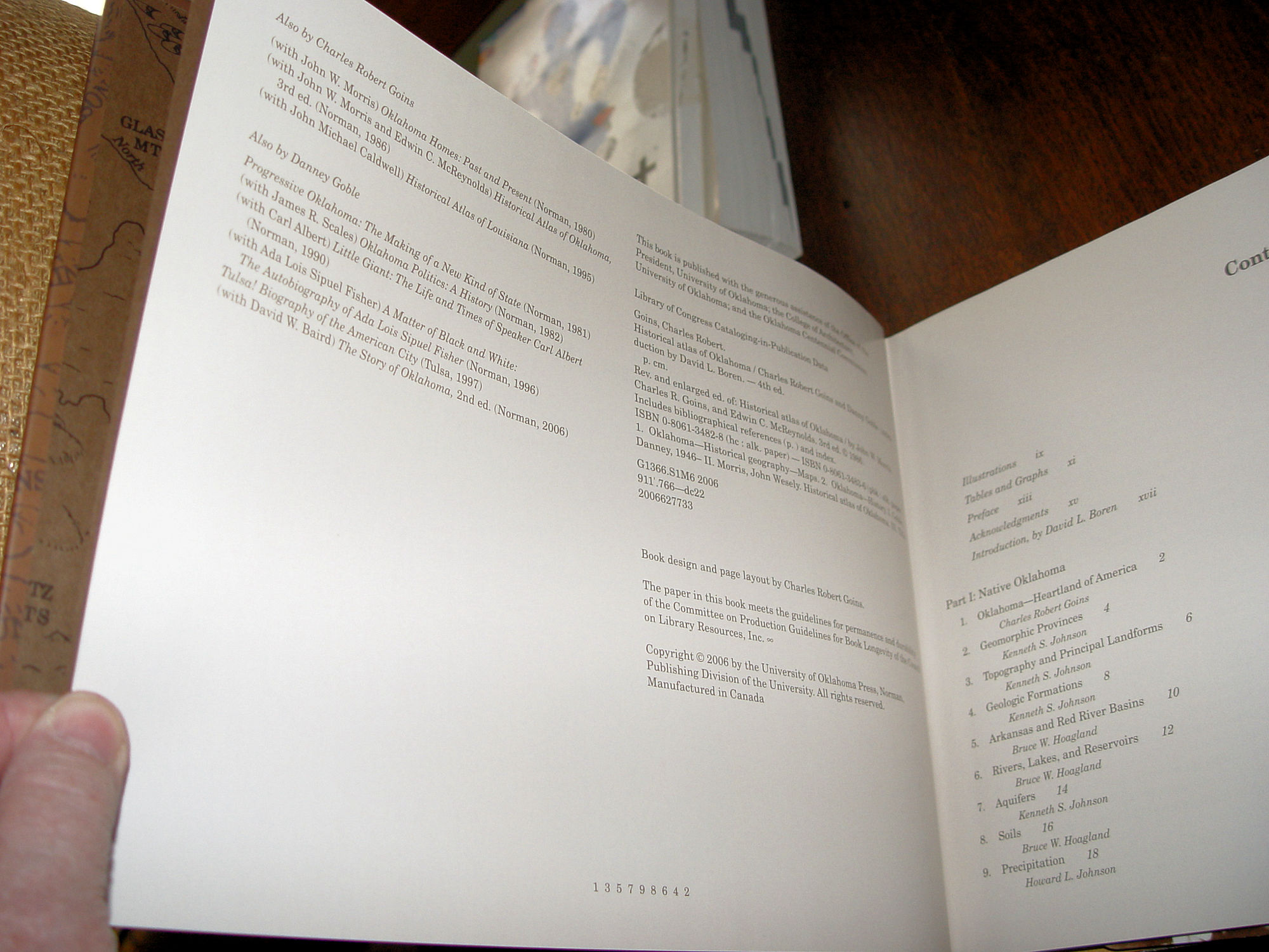
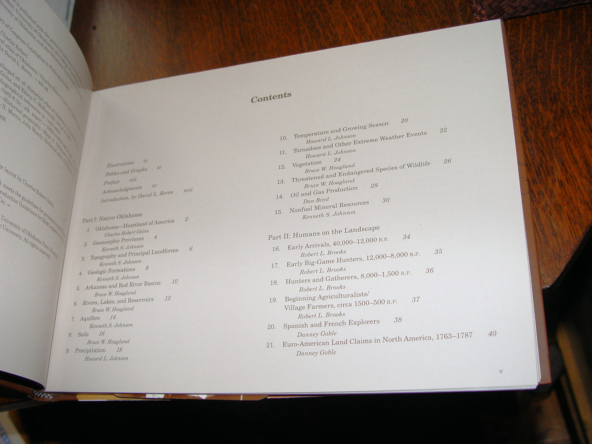
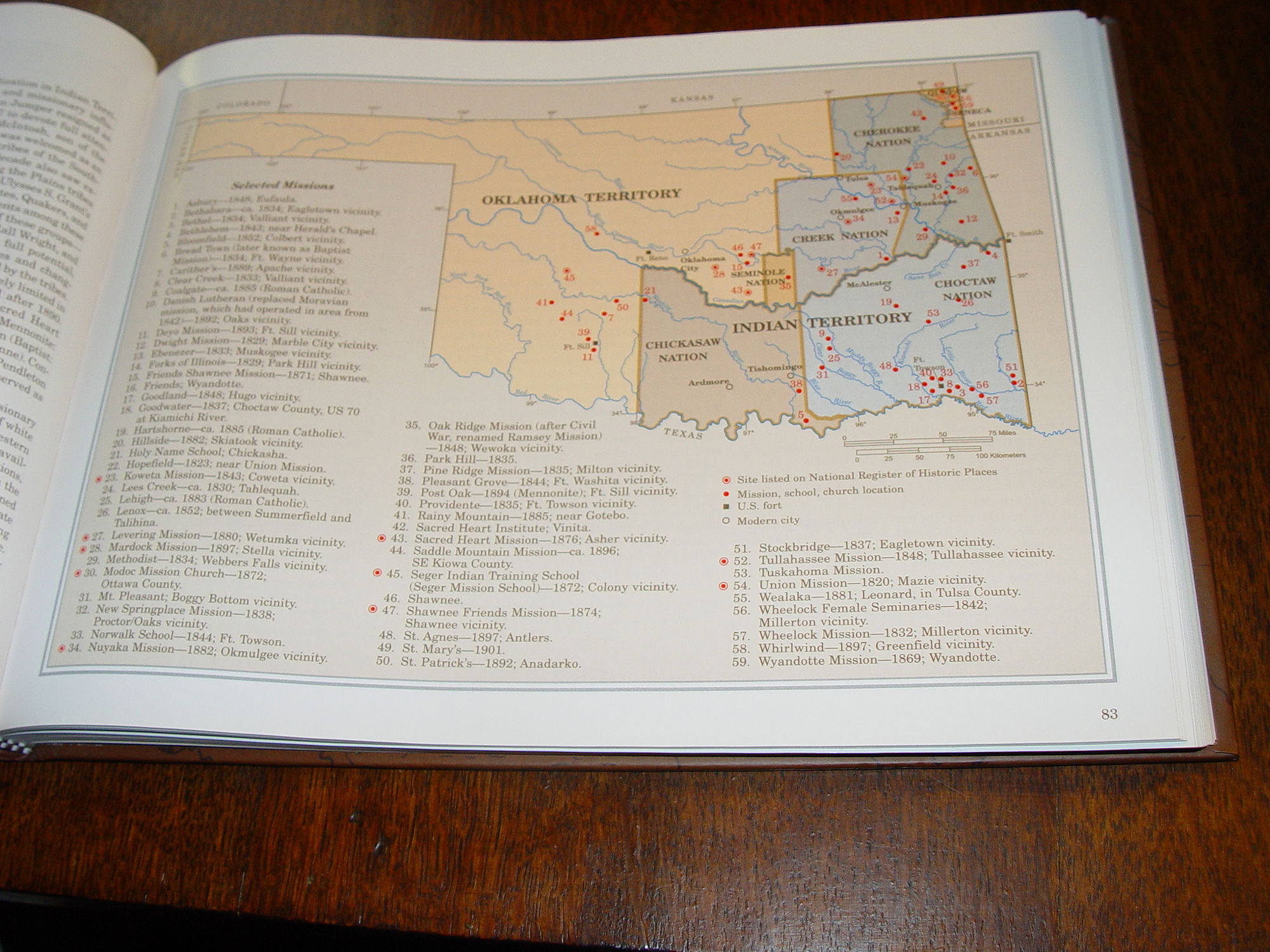
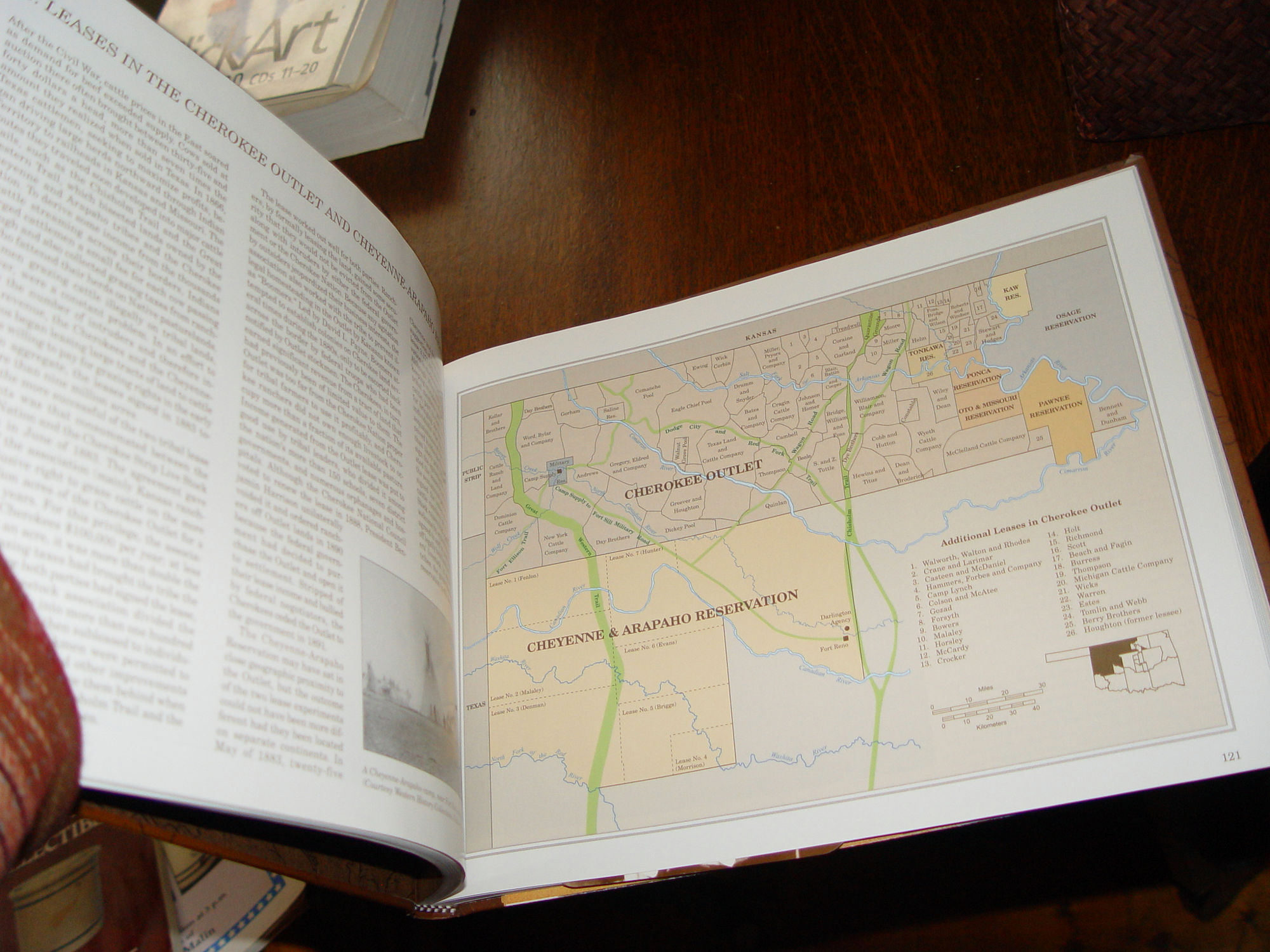
Publisher: University of Oklahoma Press 2006 ISBN-10 : 0806134828 ISBN-13 : 978-0806134826 Maps by James H. Anderson Introduction by David L. Boren 320 pages -- Approx. size: 9 by 12 inches This beautiful book was found in a professor's library. Found along with it was a brochure for the Lawton Fort Sill - Fort Sill is a United States Army post north of Lawton, Oklahoma. Mint condition. Also a Postcard of Quanah Parker, Chief of the Comanches. Large and oversized, great for a frame. Old West Collectors Series. Created by cartographer James H. Anderson, more than 170 new maps―in full color―chart Oklahoma’s rich and varied history and current population trends. Oklahoma authors Charles Robert Goins and Danney Goble are joined by seventeen contributing scholars (including natural and physical scientists) and other professionals to present 119 topics. To explore each, one or more maps with explanatory legends, tables, and graphs are paired with an interpretive essay. The Atlas describes Oklahoma’s landforms and natural resources and traces the state’s geographic history from the earliest hunter-gatherer bands to today’s mostly urban inhabitants. New to this edition are maps exploring additional aspects of the state’s economy and its diverse society, politics, and culture, such as black history, women’s experiences, and the musicians, writers, and other artists identified with the state. Reflecting the most up-to-date information as of 2005 from the U.S. Census Bureau and other sources, this new edition of the Historical Atlas of Oklahoma will be an invaluable resource for scholars, teachers, students, and any reader who wants to know more about the history of Oklahoma. This book is as new. Flawless condition. Please see photos, enlarge and email with any questions. Thanks for looking. |
|
Check out and Like our
|